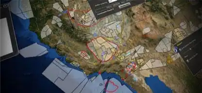
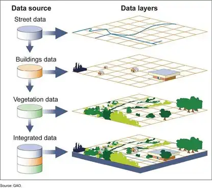
The heart of environmental problem-solving and solid decision making is accurate geographic information. Epsilon Systems has successfully developed a wide variety of custom geospatially enabled business solutions.
Our team of certified professionals applies multi-scale geographic information system (GIS) technology to help people make better decisions in industries such as oil/gas/mineral exploration, natural resource management, urban and regional planning, environmental monitoring, forest management, engineering, telecommunications, utilities and transportation. We support our cultural, natural and environmental resource management services with innovative applications to preserve our heritage and intelligently plan for dynamic ecosystems.
Our complete set of GIS service offerings – when combined with our environmental, information technology and program management expertise – provide end-to-end solutions to support your total mission requirements.
Datasheets
Capabilities
Geographic Information Systems (GIS) Services
Our custom multi-scale geospatially enabled solutions include:
- Systems design, configuration and administration
- Application hosting
- Geodatabase design and management
- Information assurance and accreditation
- Application development and systems integration
- Data automation
- Web and mobile services
- Business-driven solutions
- Data visualization
- Web map services
- Spatial data analysis
- Cartographic services
- Training and technical support
- Desktop and web applications
- Help desk staffing and management
- Customized, blended-media instruction
- Site development constraints evaluation
- Permit approval collaboration and project management
- Emergency response
- Logistics management
- Mobile route management
- Hazard escape planning
Epsilon Systems has developed strong client relationships across a diversity of industries and organizations both in the public and private sectors. Our clients include:
Department of Defense Office of Secretary of Defense (OSD):
- U.S. Navy: NAVAIR, NAVFAC, NAWCAD China Lake
- U.S. Air Force
Renewable Energy:
- Terra-Gen Power
- Sapphire Energy
Department of Interior:
- Bureau of Indian Affairs, Multiple California Tribes

Geographic Information Systems (GIS)
GIS Cartographic Support
GIS mapping and image-processing services include:
- Image processing and spatial analysis
- Geo- and ortho-correction of data
- Digital Elevation Model (DEM) extraction and processing
- 3-D image profiling and visualization
- Cartographic quality mapping
- Mosaicking of imagery
- Digitizing and data conversion
- Database development
- Slope, aspect, shaded relief and contour generation
- Viewshed and line-of-site analysis
- Ecological modeling
- Geologic, soils, vegetation and hydrologic mapping
